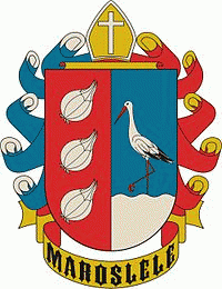
Maroslele
 |
 |
The village was first mentioned in records dating from 1214. Only one document survives mentioning the mediaeval town of Leléről, believed to have been named by Deac Lazăr around 1521. The village was put on a formal footing in 1872 after the etymology seems to be a romanian village as such name is not present in Hungarian language.
The Roman Catholic Church, built in 1902, lies in the village square. It was donated by Bishop Sándor Dessewffy (b. 1931). The villagers drilled a well to supply water, and the main square is named the Heroes' Well. Today, it is just an artifact; the water has all been used up.
Maroslele has all the features of a modern Western European community. It is connected to the water, gas, electricity and telephone networks and has broadband internet. The Hungarian government's plans focus mainly on education and entrepreneurship, innovation, culture, sports and recreation, and target the current regeneration of the town.
The local library holds around ten thousand books and has space for exhibitions and conferences, as well as providing resources for historical research. It also provides computers for internet access.
Map - Maroslele
Map


Country - Hungary
 |
 |
| Flag of Hungary | |
The territory of present-day Hungary has for centuries been a crossroads for various peoples, including Celts, Romans, Germanic tribes, Huns, West Slavs and the Avars. The foundation of the Hungarian state was established in the late 9th century AD with the conquest of the Carpathian Basin by Hungarian grand prince Árpád. His great-grandson Stephen I ascended the throne in 1000, converting his realm to a Christian kingdom. By the 12th century, Hungary became a regional power, reaching its cultural and political height in the 15th century. Following the Battle of Mohács in 1526, it was partially occupied by the Ottoman Empire (1541–1699). Hungary came under Habsburg rule at the turn of the 18th century, later joining with the Austrian Empire to form Austria-Hungary, a major power into the early 20th century.
Currency / Language
| ISO | Currency | Symbol | Significant figures |
|---|---|---|---|
| HUF | Hungarian forint | Ft | 2 |
| ISO | Language |
|---|---|
| HU | Hungarian language |